

Master Plans and Design Guidelines
Hillcrest Development Master Plan, City of Saint Paul, Minnesota
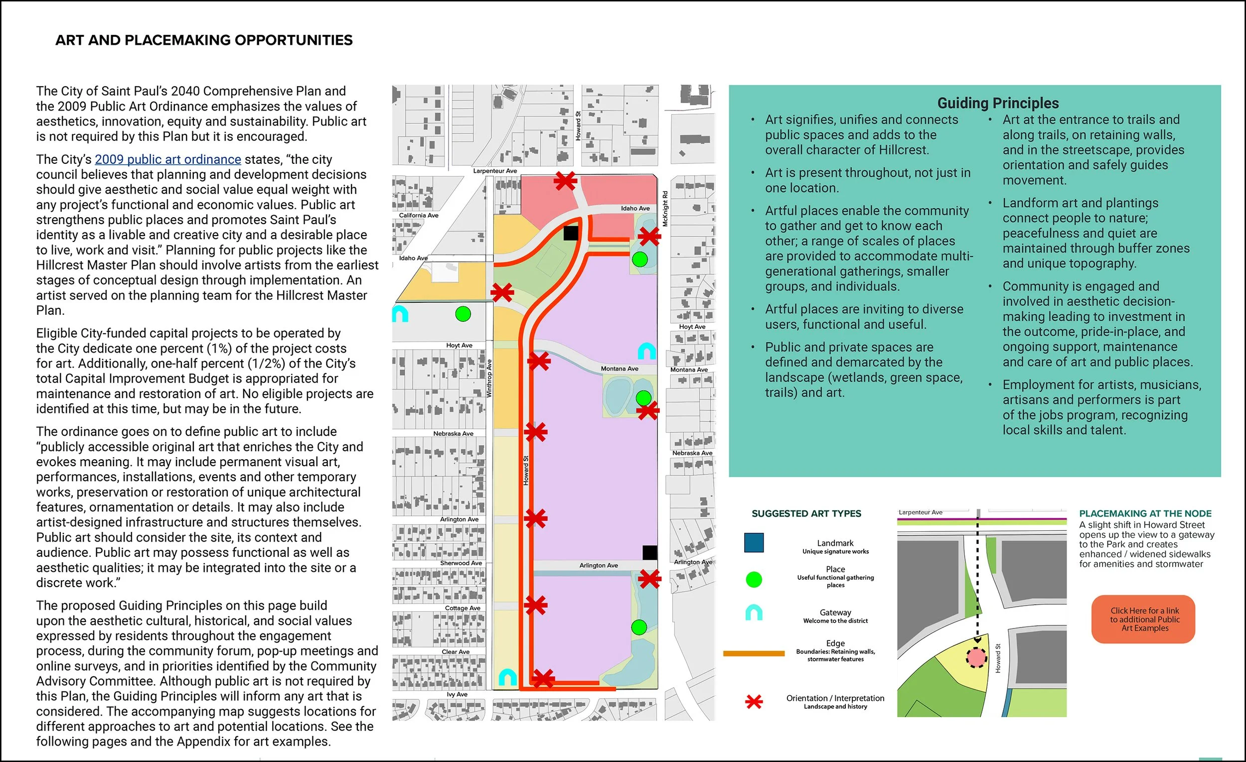
The Master Plan guides redevelopment by the Saint Paul Port Authority of a former 112-acre golf course on the far northeastern edge of Saint Paul. The project, now known as The Heights, includes the highest geographic point in the city. The Plan was prepared for the City of Saint Paul and I participated on the team led by Cuningham Group Planner Andrew Dresdner with Kimley Horn, Barr Engineering and Zan Associates. The 2009 City of Saint Paul Public Art Ordinance requires that artists are part of planning and design teams and that was my role.
I walked the East Side, producing photographic documentation to orient the team about the neighborhood’s current character; participated in devising and conducting the Community Forum that engaged the surrounding residents in dialogue about their interests; synthesized and evaluated their input; and in particular, contributed concepts and illustrations for the Plan’s Land Use, Art and Placemaking chapter.
The Guiding Principles for Art and Placemaking Opportunities build upon the aesthetic cultural, historical, and social values expressed by residents throughout the engagement process, during the Community Forum, pop-up meetings and online surveys, and in priorities identified by the project’s Community Advisory Committee.
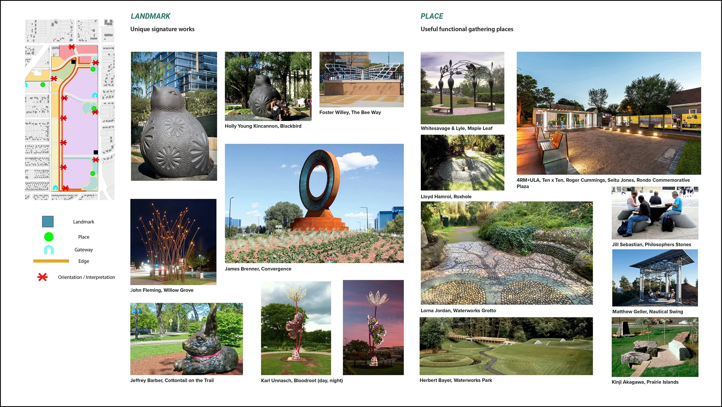
Reflecting the community’s interests, art is threaded throughout the Master Plan including in this proposed Parks and Open Space policy: “Use public art and artists to activate public spaces and help highlight and celebrate unique features of the development, including the culture of the East Side. An important differentiator of the Hillcrest development will be its ability to celebrate what is unique about the place. Public art and artists should play a significant role in helping to define and bring attention to those qualities. The design and development of the public realm should include a broad range of opportunities to incorporate public art and to host cultural events. This can include (but is not limited to) the design of retaining walls, use of landscape art to highlight topography, stormwater features, pavilions, and play structures.”

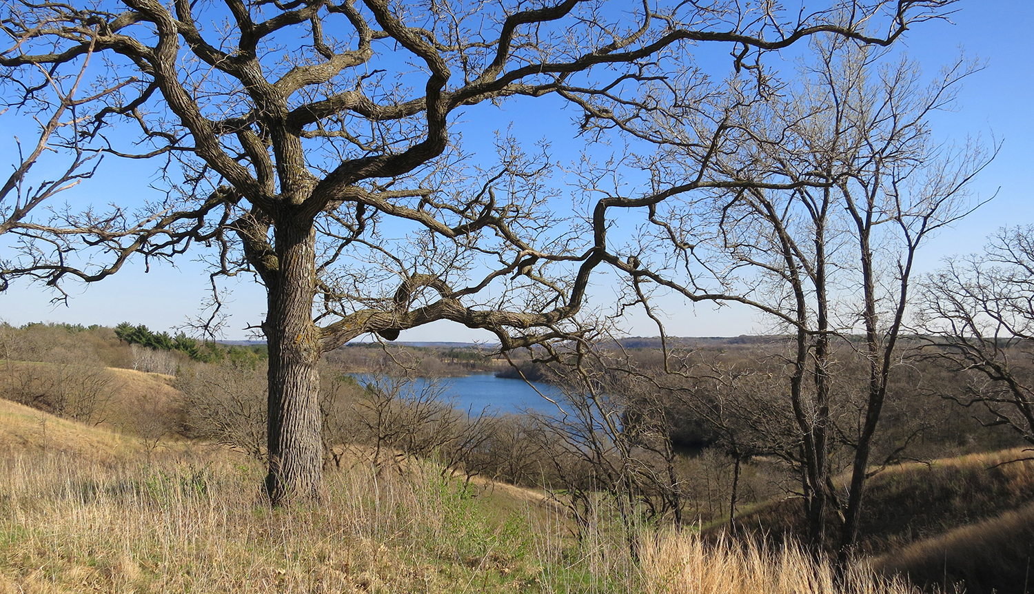
Belwin Conservancy, Afton, Minnesota
With Jim G. Hagstrom, Savanna Designs LLC, Afton, Minnesota
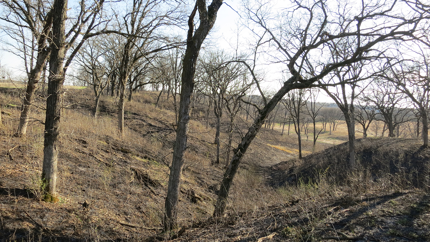
Belwin Conservancy, a private non-profit, aimed to explore creative uses for a splendid 300-acre wetland and oak savanna landscape including a complex of notable Modernist residential buildings. The organization envisions a center for nature and art that enables diverse experiences of this unique landscape.
The Master Plan has two dimensions. Design options were fleshed out for entrance locations and access, parking, a shelter building, and trail systems with overlooks and resting places.
The Plan also illustrates how artistic practice could be integrated with the landscape through site-specific art, artist-designed gathering and resting places like the Rachel Carson overlook dedicated to this early environmentalist, and outdoor studio spaces for visual artists and writers. An environmental classroom for landform art was suggested for a former gravel pit. Art examples were provided along with a preliminary development budget.
Belwin Conservancy Conceptual Master Plan for the Creative Center
Bloomington Minnesota South Loop
Streetscape Master Plan
With Kimley-Horn and Associates and SRF Consulting Group for City of Bloomington, Minnesota, Department of Public Works
Public Art chapter embedded within plans for a new district east of the Mall of America discusses conceptual approaches for integrating placemaking and public art into streetscape planning and design. Opportunities are illustrated on plans including photographic examples.
With this information, the City of Bloomington pursued the next step: successfully securing a significant National Endowment for the Arts – Art Place America grant to develop a public art plan and produce demonstration projects in the district.
Bloomington South Loop Streetscape Master Plan - Public Art Chapter illustration
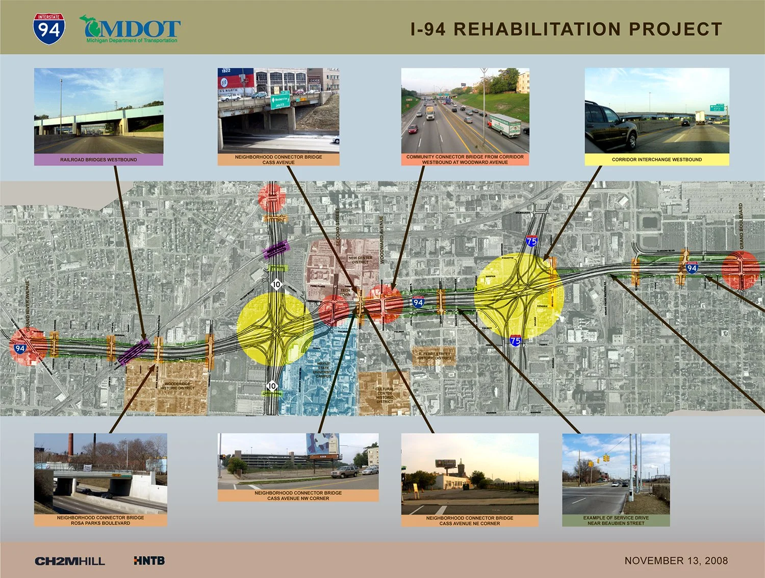
I-94 Corridor Design Guidelines, Detroit, Michigan
With HNTB Corporation
The project rehabilitates 6.7 miles of I-94 through downtown Detroit. Themes developed by the community advisory group and Michigan Department of Transportation (MDOT) informed the design team’s ideas for freeway elements including bridge piers; mechanically-stabilized-earth (MSE) retaining walls; noise walls; interchange ramp piers; lighting fixtures; and railings.
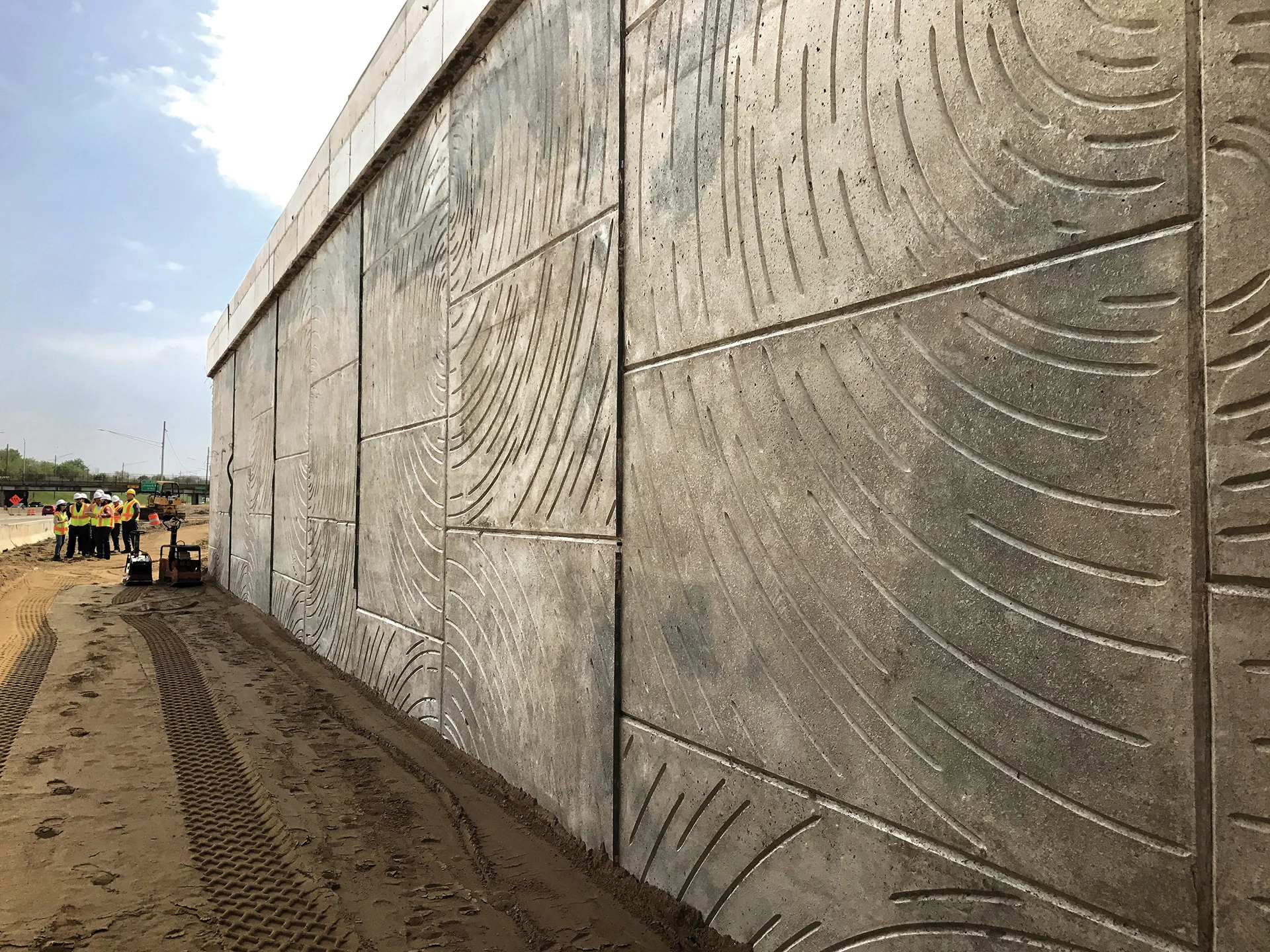
One of my design contributions, the Constellation Pattern for MSE and noise walls, was selected by the community and has been constructed. The spiraling organic abstract pattern expresses celestial imagery and references the North Star, significant in the history of the Underground Railroad and the city of Detroit.
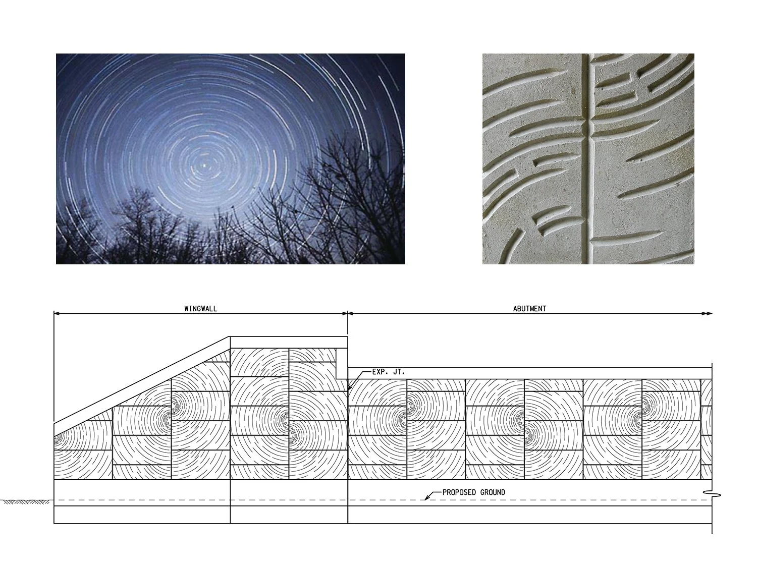
Constellation Pattern for MSE Walls
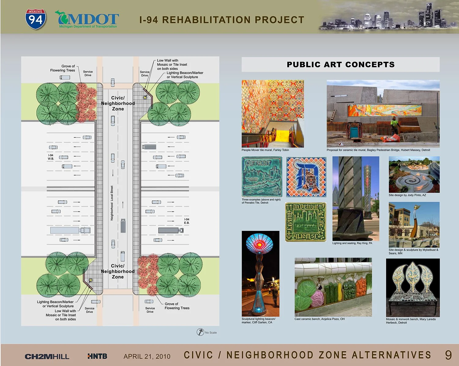
I proposed that over-crossing bridges feature Civic/ Neighborhood Zones where the individuality of each neighborhood could be expressed in public art, paving and special plantings.
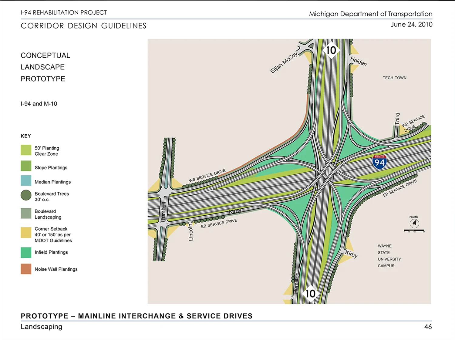
I contributed conceptual landscape prototypes featuring a diverse MDOT-approved plant palette for interchanges, mainline and the service drives adjacent to the neighborhoods.

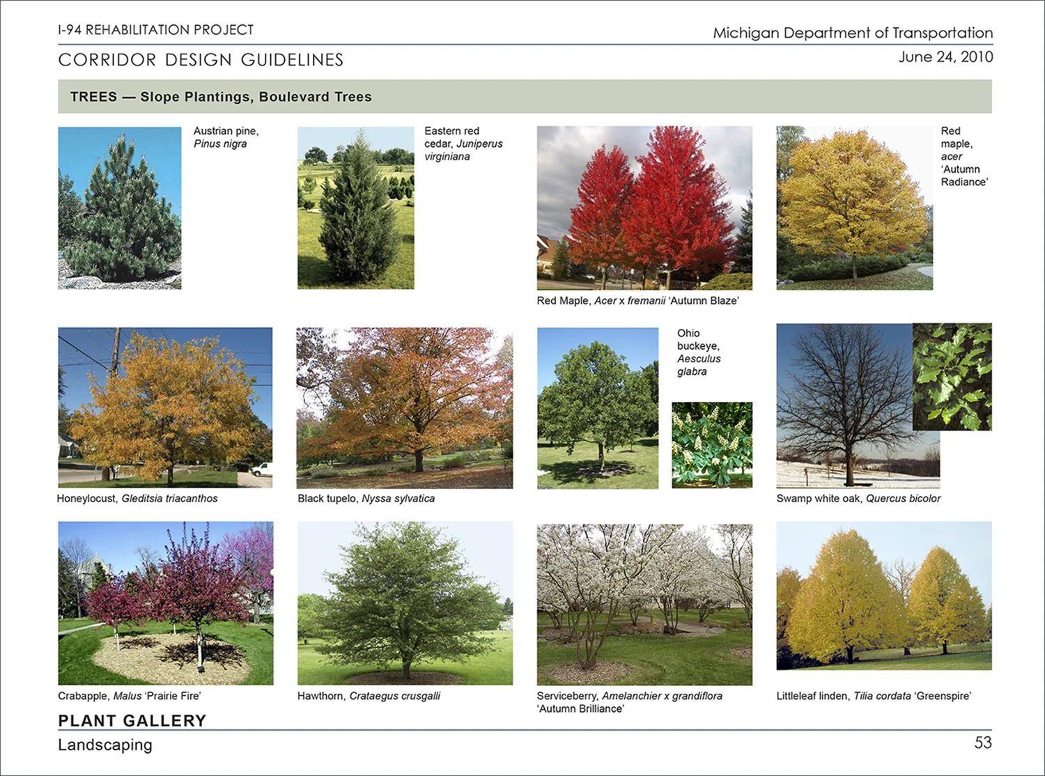
Additionally, I was content author, editor, photographer and graphic designer for community meeting presentation materials and for the Design Guidelines.
Western Park Neighborhood Assessment, Saint Paul, Minnesota
The Western Park Neighborhood west of the State Capitol and south of University Avenue resulted from the construction of Interstate 94 in the 1970s and “slum clearance” urban renewal efforts that split the Rondo Neighborhood. In 1998, Public Art Saint Paul (PASP), a private non-profit arts organization working with the City of Saint Paul developed a leftover vacant parcel into Western Park, a venue for the display of sculpture.
During 2002-2004, PASP conducted a comprehensive urban design and landscape assessment of the physical, social and economic impact of what is now known as Western Sculpture Park on the diverse surrounding neighborhood and how this asset could be more useful to the community. This forgotten neighborhood had been left out of most existing plans and the Assessment’s scope expanded to remedy the situation.
I summarized and critically analyzed existing plans for the University Avenue corridor, surrounding neighborhoods, and parcels controlled by the State of Minnesota, and produced base-line documentation and maps of businesses, parks, residences and physical conditions in the public realm including green infrastructure.
I employed Saint Paul Design for Public Safety: A Guide for Making a Safer Public Realm with principles built upon Community Policing Through Environmental Design (CPTED) and assessed the quality and safety of green infrastructure and connections between Western Sculpture Park, Central Village Park and the playing fields at the Ober Community Center. Mapping and photography identified hot spots, hazardous conditions and places lacking surveillance, considering how children typically navigate the neighborhood to access the parks and playing fields.
The Assessment was overseen by a neighborhood advisory committee and the recommendations in the final document were used by PASP to determine arts programming for the park and by the City for land use decisions and streetscape improvements, especially on Western Avenue.